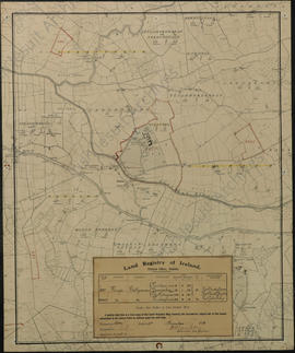
Map of the Town of Philipstown, King's County, estate of 4th Viscount Molesworth
- IE OH OHS 88
- Fonds
- 1786
Canvas-backed paper map of the former county town of Philipstown (Daingean) compiled by Arthur Richards Neville in June 1786 for Richard Nassau Molesworth, 4th Viscount Molesworth (1748-1793). The map covers 2887 statute acres and includes environs of the town. The plots are numbered 1-130 with an accompanying reference table describing the contents of each land-holding unit. The reference is tabular, listing tenants' name, description of the holdings (e.g. 'a very fine farm all good meadow', 'good high Meadow & Pasture', 'great red bog', 'poor ground' etc) a yearly value and a sum total of the east and south east side of Philipstown.
Scale 20 perch to the inch (1:5040)
Neville, Arthur Richards